 Malaga City Guide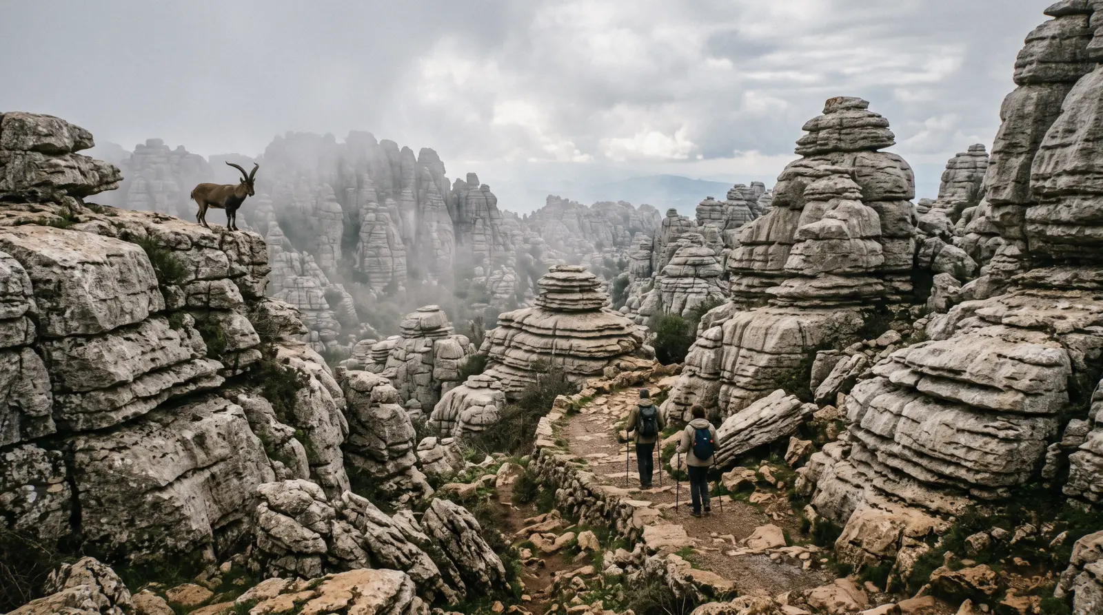
El Torcal de Antequera
El Torcal de Antequera is a plateau of limestone stacked like plates, 1,200 m up above Antequera, a Paraje Natural since 1989 and half of the town's UNESCO property with the dolmens. It is free, it never closes, and there is no public transport to it at all, which the official site says in as many words. This page is the three marked routes and their times, the visitor centre whose hours are printed three ways, the weekend rule that shuts the road when a 52-space car park fills, the shuttle whose fare is printed as both $2.33 (€2) and $3.50 (€3), and the guided hikes from Málaga that solve the transport. The dolmens and the town are on the Antequera page. The rest of the ring is on the day trips hub.
Quick answer Free, no bus, three routes, one weekend rule
El Torcal de Antequera is free, open at all hours, and has no public transport: the official site says there is still no bus to the Torcal, so you arrive by car, by taxi from Antequera, or on a tour. Three marked routes leave the Torcal Alto visitor centre, 45 minutes, 2 hours and 3 hours round trip, and on weekends and holidays the road up closes to cars once the 52-space car park is full, with a shuttle from the lower car park at $3.50 (€3) return.
Key takeaways
- Without a car, the guided hike from Málaga in an 8-seat van at $63.98 is the only option that brings you back to the city. The Antequera-start hike at $48.86 is cheaper if you take the M-253 bus to town yourself
- Do the yellow route: 3 km, 2 hours, through the Hoyo de las Ventanillas into the Torcal Bajo, which is the landscape the photographs show. The green route is 45 minutes and stays near the car park (the routes)
- It is 1,200 m up and the tours ask for warm layers even in spring. The Málaga weather page is the coast, and the plateau runs colder
- Pair it with the Antequera dolmens on the dolmens and Torcal day, the one trip that does both UNESCO sites with a guide
Key facts
Opening hours
| The Paraje and the trails | Open country–No closing time |
|---|---|
| Visitor centre, per the how-to-visit page | 09:30–17:30 |
| Visitor centre, per the FAQ | 09:30–17:00 |
| Visitor centre, per the homepage, Nov–Mar / Apr–Oct | 10:00–17:00 / 19:00 |
Closed Trails never. Visitor centre closed 25 December, 1 and 6 January. 24 and 31 December and 5 January to 14:00
Admission
- Adult
- Free. Shuttle from the lower car park $3.50 (€3) return per the 2026 restriction page, $2.33 (€2) per the Junta ficha and older pages
- Reduced
- Not applicable. Shuttle free under 3 on the older pages
- Free
- Everything except the shuttle
Planning it
- Time needed
- Green route 45 minutes, yellow 2 hours, orange 3 hours round trip, per the official routes page
- Book ahead
- Optional — walk-up usually fine
- Address
- Centro de Visitantes Torcal Alto, Ctra. de acceso al Torcal Alto km 3.5, 29200 Antequera. Lower car park on the A-7075 between km 41 and 42
El Torcal sells no ticket. The Paraje Natural, the trails and the visitor centre are free. What costs money is getting there, so the rows below are the official free entry followed by the three guided hikes on GetYourGuide, priced as listed on in Q3 2026. The official row links the operator's own how-to-visit page with no affiliate code.
You are not paying for the Torcal. You are paying for a van, a guide who knows the route, and a way back. Do you need all three, or just the last one?
| Option | Price | Includes | Cancel | Book |
|---|---|---|---|---|
| Free entry, own transportAnyone with a car or a taxi fare from Antequera. The taxi fare is not published | Free. Shuttle $3.50 (€3) on restriction days | All three routes, the Ventanillas viewpoint, the visitor centre | Nothing to cancel | Official site |
| Guided hiking tour from Málaga, 8-seat van, 5 hVisitors without a car who want to end the day in Málaga. Under-8s excluded | $63.98 | About 50 minutes each way from Calle Ordóñez, 3-hour guided walk, water. Back to the same street | Free up to 24 hours before | Check Availability |
| Guided Ammonites Route hike from Málaga, 5 hWalkers who want the afternoon in Antequera and do not mind the public bus home | $75.62 | Van from Málaga, 4.5 km guided walk with sticks, drop in Antequera, M-253 bus ticket back | Free up to 24 hours before | Check Availability |
| Ammonites Route hike with transfer from Antequera, 4 hAnyone already in Antequera by bus or train. The cheapest guided Torcal there is | $48.86 | Vintage van from Puerta de Estepa or your Antequera hotel, 20 minutes each way, sticks, a snack and sweet wine | Free up to 24 hours before | Check Availability |
The two Visita Antequera hikes walk the same 4.5 km Ammonites Route at 1,200 m with a group capped at eight. The difference between $75.62 and $48.86 is the van from Málaga. The Málaga Activa listing is the only one that returns you to the city.
El Torcal Hikes From Málaga and Antequera Compared
Three guided walks, all with eight seats and none with a ticket to buy, because there is none. USD prices as listed in Q3 2026. The two days that add the dolmens are on the Antequera page.
 from $63.98
Most reviewed
from $63.98
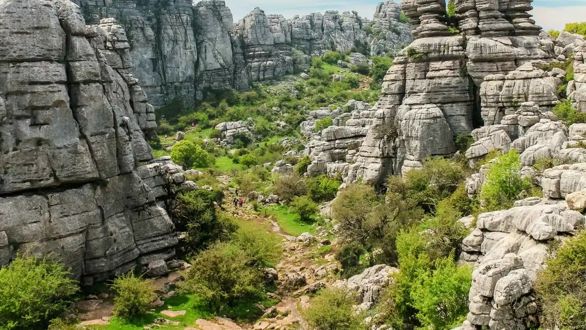
Most reviewed From Malaga: Torcal de Antequera Hiking Tour
Van out, three hours walking among the Sphinx, Screw and Cathedral rock shapes with a local guide, van back to the same Málaga street: the only Torcal trip in the group that brings you back to the city itself. Eight seats, under-8s excluded, water included, no food.
Check Availability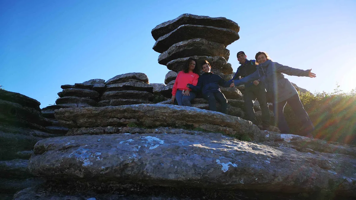 from $75.62
From Málaga: Guided Hike in El Torcal de Antequera
A guided 4.5 km walk of the Ammonites Route through El Torcal's karst with a group capped at eight, then time in Antequera before you take the public bus back to Málaga on a ticket the guide hands you. Warm layers are needed at 1,200 m, and there is no food included.
Check Availability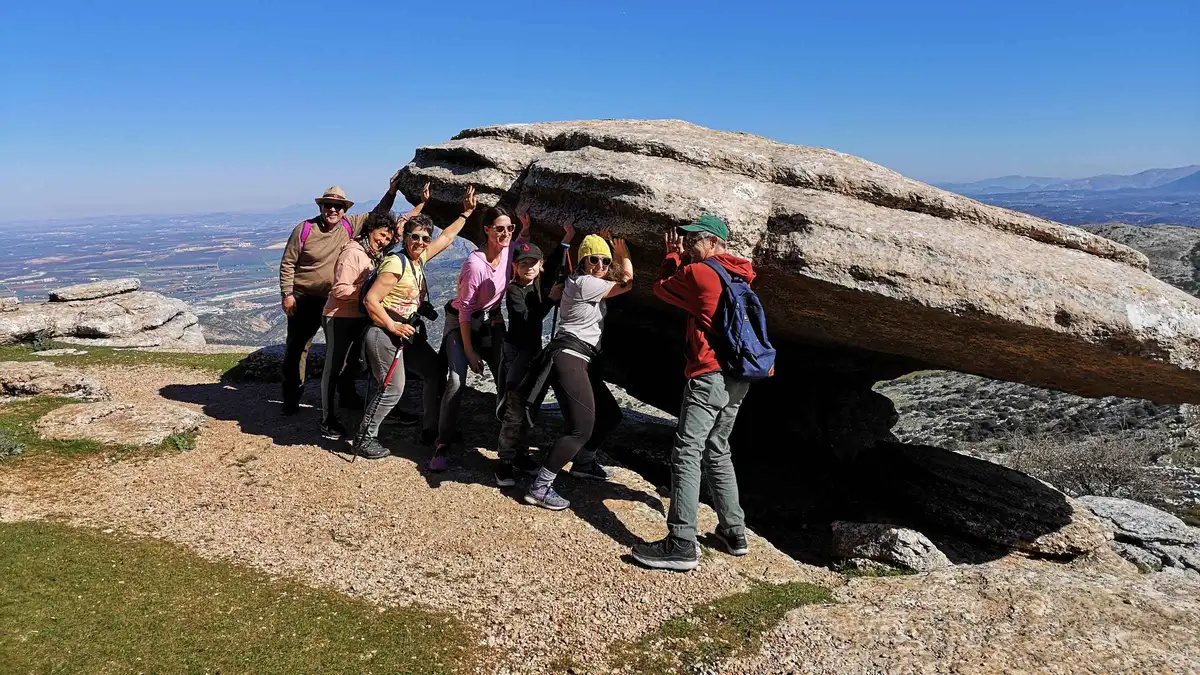 from $48.86
Cheapest entry
from $48.86
Cheapest entry El Torcal de Antequera Hike with Transfer
The same guided Ammonites Route hike as the Málaga departure, but starting in Antequera with hotel pickup in town, which is why it is the cheapest Torcal option. You get yourself to Antequera. Walking sticks, a snack and a glass of sweet wine are included; eight people maximum.
Check AvailabilityPrices, ratings and details are the platform's own; dollar figures are the listed prices — the platform bills in your account's currency.
What El Torcal Is: a Seabed Stood on End
The Paraje Natural Torcal de Antequera was declared on 28 July 1989 and the Junta's ficha gives it 21,280 ha. The visitor centre at Torcal Alto is run by a private concessionaire, ISP, and it is the only building on the plateau.
The limestone here was laid down under the Tethys sea, which is why the tours sell it as a walk over stones that were 200 million years underwater and why one of the routes is named for the ammonites you can find in the rock. Lifted and then dissolved along its joints, the plateau weathered into the stacked-plate towers, corridors and sinkholes that make it look built. The Junta lists the Tornillo del Torcal, a single screw-shaped stack, as a natural monument in its own right, declared 23 November 2001, 0.20 ha, and it is 500 m from the centre on an accessible path.
The plateau sits at about 1,200 m, which the tour listings repeat because it matters: it is cold when Antequera is mild, and the cloud can sit on it when the town is in sun. Ibex are the animal everyone asks about and the rock the thing they came for. The visitor centre has the geology, and its hours are the one thing on the plateau that is not straightforward.
The Three Routes: Green, Yellow and Orange
From the official routes page and the Junta's Ventana del Visitante fichas, read in Q3 2026. The two sources differ on the lengths by a few hundred metres. Both are printed. All three are free and unguided, waymarked in their colour, and start at or end at the Torcal Alto car park.
The green route is the short loop everyone with an hour does: 1.5 km on the official page, 1,408 m on the Junta's, circular from the Torcal Alto car park, 45 minutes, medium-low, passing near the Mirador de las Ventanillas. The yellow route is the one to do if you have two hours: 3 km on the official page, 2,722 m on the Junta's, circular, medium, extending the green loop through the Hoyo de las Ventanillas down into the Torcal Bajo and back up, which is where the corridors and towers are at their densest. The orange route, the Subida al Torcal Alto, is different in kind: 3.6 km one way on the official page, 3,780 m on the Junta's, linear from the lower car park on the A-7075 up past the Tornillo to the centre, 1.5 hours up and 3 hours round trip, medium. On a restriction day it is the walk that replaces the shuttle.
Two short accessible paths run from the centre: 100 m to the Mirador de las Ventanillas, the balcony over the plain to Antequera and the Peña de los Enamorados, and 500 m each way to the Tornillo.
| Route | Length | Time | Shape | Starts |
|---|---|---|---|---|
| Green, Ruta Verde | 1.5 km (Junta: 1,408 m) | 45 min, medium-low | Circular | Torcal Alto car park |
| Yellow, Ruta Amarilla | 3 km (Junta: 2,722 m) | 2 h, medium | Circular, via Hoyo de las Ventanillas | Torcal Alto car park |
| Orange, Subida al Torcal Alto | 3.6 km one way (Junta: 3,780 m) | 1.5 h up, 3 h round trip | Linear, via the Tornillo | Lower car park, A-7075 km 41–42 |
| Mirador de las Ventanillas | 100 m | Minutes | Linear, accessible | Visitor centre |
| Tornillo del Torcal | 500 m each way | About 20 min | Linear, accessible | Visitor centre |
The Guided Ammonites Route
The three GetYourGuide hikes walk what their operator calls the Ammonites Route, 4.5 km over rock at 1,200 m with walking sticks supplied and vertigo listed as an exclusion, or in the Málaga Activa listing a three-hour walk past the Sphinx, the Screw and the Cathedral rock shapes. That is a guided variant, not one of the Junta's waymarked colours, and the operator's own site says guided visits are arranged by email with no price published. Wild climbing is allowed only in the eight zones the Junta named in BOJA 136 of 2018.
Camping and campervan overnighting are banned under Decreto 222/2013. Dogs on a lead only.
Getting There: No Bus, a Car Park That Fills, and a Shuttle Printed Two Ways
From the official site's how-to-get-there, how-to-visit and restriction-of-access pages and the Junta's ficha, read in Q3 2026.
No Public Transport
The official site states it plainly: there is still no public transport to the Torcal. The options it lists are a taxi from Antequera, whose fare it does not publish, a guided tour with transport, or a car. From Málaga by car, take the A-45 to the Casabermeja exit, exit 124, then the A-7075 towards Villanueva de la Concepción and on towards Antequera to the Torcal Alto turn-off.
From Antequera the A-7075 past Boca del Asno to about km 42. The visitor centre is at km 3.5 of the access road. Without a car the honest sequence is the M-253 bus from Málaga to Antequera, about an hour, then a taxi or the Antequera-start hike, whose van does the last 20 minutes.
The Antequera page has the bus times.
The Restriction and the Shuttle
The upper car park at Torcal Alto holds 52 cars, 14 buses and 3 disabled spaces and is unguarded. On weekends and holidays, and on what the 2026 page calls weekdays in spring 2026, the road up closes to private cars once that car park is full, with no fixed time, and reopens between 14:00 and 15:00 depending on the season. Buses, taxis, disabled-permit and service vehicles are exempt. When it is closed you park in the lower car park beside the A-7075 between km 41 and 42, at the old Venta del Rosario, and take the shuttle up.
The shuttle's price is the fact this page has to print twice. The 2026 restriction page says $3.50 (€3) per person return. The site's own homepage and how-to-visit page, and the Junta's ficha, still say $2.33 (€2), under-3s free. We print both because the operator does. Carry cash for the higher one. Two buses run at high frequency on weekends, one about every 30 minutes on spring weekdays, and there is no service at all from 13:30 to 15:00 for the driver's rest, which on a Sunday means the orange route on foot or a wait.
| Item | What the operator prints | Source |
|---|---|---|
| Shuttle fare, return | $3.50 (€3) | Restriction-of-access page, 2026 |
| Shuttle fare, return | $2.33 (€2), under 3 free | Homepage, how-to-visit page, Junta ficha |
| When the road closes | Weekends, holidays and spring 2026 weekdays, once the 52-space upper car park is full. No fixed time | Restriction-of-access page |
| When it reopens | 14:00 to 15:00 by season | Restriction-of-access page |
| Shuttle gap | No service 13:30–15:00 | Restriction-of-access page |
| Lower car park capacity | Not stated. The page says limited | Restriction-of-access page |
The Visitor Centre, and Its Three Sets of Hours
The Centro de Visitantes Torcal Alto is free and holds the geology exhibition, the toilets, the only food on the plateau and the trailheads. Its opening hours are printed three different ways on the operator's own site, and this page refuses to pick one for you: the how-to-visit page says 09:30 to 17:30 every day, the FAQ says 09:30 to 17:00, and the homepage gives winter hours of 10:00 to 17:00 from November to March and summer hours of 10:00 to 19:00 from April to October. What all three agree on is the Christmas pattern: closed on 25 December and 1 and 6 January, and open only to 14:00 on 24 and 31 December and 5 January. A last-entry time is not stated. The Junta's own 2026 hours tab is rendered by a script and could not be read.
None of this affects the walk. The trails are open country and the green and yellow loops start in the car park, so an early start is never wasted. It only means the centre is shut when you get back. The Antequera page has the town's hours if you are combining the two, and the hiking page the other walks around Málaga.
How Much Time To Give El Torcal
The operator publishes route times rather than a visit length, so the routings below are built from those and the transport.
The plateau itself takes as long as the route you pick, from 45 minutes to 3 hours. What decides the day is the drive, and on a weekend the shuttle.
| Routing | What you get | What it skips | Door to door from Málaga |
|---|---|---|---|
| Green loop by car, weekday | The 45-minute loop, the Ventanillas viewpoint, the centre | The Torcal Bajo corridors on the yellow route | About 3 hours. Roughly an hour's drive each way |
| Yellow loop, guided van | The 8-seat van from Calle Ordóñez, a 3-hour guided walk, water, back to the same street | Antequera and the dolmens | 5 hours. $63.98 |
| Both UNESCO sites | The dolmens and Torcal day: 90 minutes at the dolmens, 90 in the Torcal, free time in Antequera, bus back | The orange route and the full yellow loop | 5 hours of tour plus the M-253 back. $75.62 |
Eating at El Torcal
The visitor centre is the only place on the plateau, and the operator publishes no menu and no prices, so this site prints none. The tours carry their own answer, water on the Málaga van hike and a snack with a glass of sweet wine on the Antequera-start hike, and none of them a meal. Bring food if you are walking the yellow or orange routes, because there is nothing on them and the shuttle gap from 13:30 to 15:00 can leave you on the wrong side of lunch.
Antequera below has the porra antequerana and the molletes. The where to eat page is for the evening back on the coast.
Five Things Most Visitors Do Not Know About El Torcal
Each of these comes off an official page and changes something practical about the day.
- The shuttle fare is printed as two different prices by the same operator. $3.50 (€3) return on the 2026 restriction page, $2.33 (€2) on the homepage, the how-to-visit page and the Junta ficha. Carry cash for the higher one [torcaldeantequera.com restriction-of-access and how-to-visit pages. Junta ficha 19625, read in Q3 2026]. - The road closure has no time. On weekends and holidays, and on spring 2026 weekdays, the road up shuts when 52 cars are parked, whenever that is, and reopens between 14:00 and 15:00 [torcaldeantequera.com restriction-of-access page]. - The shuttle stops for lunch. No service between 13:30 and 15:00 for the driver's rest, which is exactly when the road is reopening [torcaldeantequera.com restriction-of-access page]. - The visitor centre's hours are published three ways on one website. 09:30–17:30, 09:30–17:00, and 10:00–17:00 or 10:00–19:00 by season, on the how-to-visit page, the FAQ and the homepage respectively [torcaldeantequera.com, all three pages, read in Q3 2026]. - The routes are shorter on the Junta's fichas than on the operator's page. Green 1,408 m against 1.5 km, yellow 2,722 m against 3 km, and the Subida 3,780 m against 3.6 km.
The times agree [Junta Ventana del Visitante fichas for ruta-verde, ruta-amarilla and subida-al-torcal-alto. Torcaldeantequera.com routes page].
El Torcal Map: Visitor Centre, Lower Car Park and Antequera
The plateau, the two car parks the restriction moves you between, and the town below. Coordinates from Wikidata and the operator's road descriptions, read in Q3 2026. The lower car park pin is placed from the A-7075 kilometre reference and is approximate.
El Torcal, Antequera and the Caminito are their Wikidata items. The dolmen pin is placed from the street address and the lower car park from the kilometre reference, both approximate.
Next Stop From El Torcal
Road times from the tour listings and the official pages. There is no public transport from the plateau.
Antequera
The dolmens at $1.75 (€1.50), the fortress and Colegiata free on Tuesday afternoons, and the M-253 bus back to Málaga until 19:30. Antequera is where any Torcal day without a car begins and ends.
About 20 to 30 minutes by vanCaminito del Rey
The ticketed walkway at $11.65 (€10), closed Mondays, with a train from Málaga. The Caminito del Rey is a separate day. The Torcal is the one that never closes.
West across the sierra, by car onlyEl Torcal de Antequera Questions
How long does it take to walk El Torcal de Antequera?
45 minutes on the green loop, 2 hours on the yellow loop, and 3 hours round trip on the orange Subida al Torcal Alto from the lower car park, per the official routes page. The guided hikes walk a 4.5 km Ammonites Route in about 3 hours. The Málaga van hike is 5 hours door to door. The routes table has lengths from both the operator and the Junta.
How do you get to El Torcal de Antequera from Málaga?
By car on the A-45 to the Casabermeja exit and the A-7075, or on a tour. There is no public transport to the plateau, in the official site's own words. Without a car the guided hike in an 8-seat van is the only option that returns you to Málaga, or take the M-253 bus to Antequera and the Antequera-start hike from there. The Antequera page has the bus times.
Is El Torcal free?
Yes. The Paraje Natural, the three marked routes and the visitor centre cost nothing. The only charge is the shuttle from the lower car park on days the road is closed to cars, printed as $3.50 (€3) return on the 2026 restriction page and $2.33 (€2) elsewhere on the same site. The access section explains when it runs.
What does Torcal mean?
A torcal is the Spanish word for exactly this kind of landscape: a limestone plateau dissolved into sinkholes and stacked rock, from the same root as torcer, to twist. The Junta lists the Tornillo, the screw, as a separate natural monument 500 m from the centre. The routes section has the accessible path to it.
Which animals live in El Torcal?
The ibex is the one visitors come across on the rock, and the Junta's classification of the Paraje covers the raptors of the sierra as well. The operator's pages do not publish a species list, so this site does not either. What is published is the rule: dogs on a lead only, no camping, and climbing only in the eight zones the Junta named in BOJA 136 of 2018. The hiking page collects the rules for the rest of the province.
When does the road to El Torcal close?
On weekends and holidays, and on spring 2026 weekdays, once the 52-space upper car park is full, with no fixed time, reopening between 14:00 and 15:00 by season. Then you park at the lower car park on the A-7075 between km 41 and 42 and take the shuttle, which does not run 13:30 to 15:00, or walk the 3.6 km orange route up. A weekday morning avoids all of it. The guided hikes arrive by van, which is exempt.
Is El Torcal suitable for children?
The green loop is 45 minutes on a waymarked path from the car park and has no age limit, and the 100 m Ventanillas path is accessible, so yes for the short version. The Torcal is the natural day for a family the Caminito del Rey turns away for being under eight. The Málaga Activa hike excludes under-8s and the Ammonites Route hikes exclude vertigo, so the guided walks are for older children. Warm layers at 1,200 m.
Where El Torcal Fits in a Málaga Trip
It is the day for a car, or for the dolmens and Torcal tour that does both UNESCO sites at once. On its own by van it is a five-hour half day. It is also the Monday, because the plateau never closes and the Caminito del Rey does, and it is the day for a family the walkway will not admit.
It sits in a stay of three days or more, and the three-day itinerary shows where. The rest of the inland ring is on the day trips hub, and the whole Málaga city guide starts from the homepage.
El Torcal on Film: the Rock, the Routes and the Ammonites
Three films of the plateau itself, which no route table conveys: the scale of the stacked towers, the waymarked loop through them, and the guided Ammonites Route the tours walk.
El Torcal de Antequera, Málaga
The plateau and its formations in a short overview, useful for scale before you pick a route.
Video: Andalucía ViajesEl Torcal de Antequera: a stone city near Málaga
The walk through the corridors of the Torcal Bajo that the yellow route reaches.
Video: Daring to Be FreeTorcal de Antequera | Ammonite Route
The Ammonites Route the guided hikes walk, filmed on the rock.
Video: De Rutas y SendasVideos load from YouTube only when you press play.
Prices, hours and terms are set by the venue or operator and confirmed at checkout.
We may earn a commission if you book through one of our links, at no extra cost to you. Full affiliate disclosure