 Malaga City Guide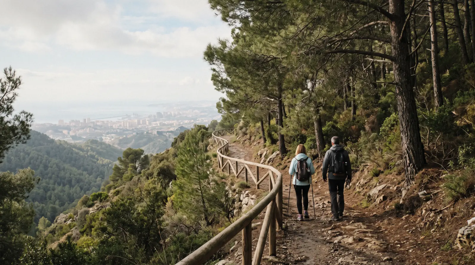
Málaga Hiking: The Montes de Málaga Trails, Monte San Antón and the Coast Path
Málaga hiking is closer than the mountains behind the city suggest. The Parque Natural Montes de Málaga, 4,992.85 hectares of Aleppo pine on the ridge north of the city, publishes four signposted senderos and two cycle routes on the Junta de Andalucía's Ventana del Visitante, with lengths to the metre. The Ayuntamiento publishes three routes up Monte de San Antón, the twin-topped hill above El Palo. The Gran Senda de Málaga's first stage runs 15.6 km along the coast from the city to Rincón de la Victoria without a climb. And the Gibralfaro hill inside the city is a 20-minute walk up a paved path to a 132 m castle. This page prints all of them from the official sheets, read in Q3 2026, with the difficulty grades the authorities use rather than adjectives, and it says where the official sources go quiet: no bus into the park, no hours for the ecomuseum, no municipal page for two of the hills people ask about. The two hikes most searches are really after, the gorge walkway an hour north-west and the limestone labyrinth above Antequera, have their own pages: Caminito del Rey and El Torcal. This one is the walking you can do from a city bed. Every other decision of the trip, from tickets to the day trips, starts on the main Málaga guide.
Quick answer The nearest trail, the longest, and how to reach them, in three lines
The nearest official Málaga hiking is the Montes de Málaga natural park, about 20 km up the A-7000 from the city, where the Junta signposts four senderos of 842 m to 2,942 m taking 30 minutes to an hour and a half, all free, and none served by a bus that any Junta sheet names. Inside the city, the Gibralfaro path climbs 132 m in about 20 minutes and Monte de San Antón above El Palo has three municipal routes of 2.5 to 3.5 hours to summits of 491 and 507 m. The flat option is stage 1 of the GR-249, 15.6 km along the coast to Rincón de la Victoria in 3 h 20.
Key takeaways
- Without a car, the Montes are reached on the Picapedreros to Boticario route from San Telmo on the city edge, the horseback hour at $58.17 or the e-bike tour at $76.78, which pedals into the park from a centre shop. The trail table has the four senderos.
- The big walks are elsewhere: the Caminito del Rey is a timed, named ticket that sells out weeks ahead, and El Torcal has a guided hike from Málaga at $63.98. The day-trips hub puts them side by side.
- The average daily high is 29.2°C in July and August and 15.4°C in January, so the walking season is October to May and every summer route starts at dawn. The weather page has all twelve months.
- The free hill walk in the city is Gibralfaro, up Paseo de Don Juan Temboury from the Alcazaba side. The castle itself is $8.16 (€7) and free on Sundays from 14:00.
The Four Official Montes de Málaga Trails and Two Cycle Routes
These are the routes the Junta de Andalucía's Ventana del Visitante lists for the park, with the distance, time and difficulty printed on each trail's own sheet. The two cycle routes are from the park leaflet. Two names that circulate online, 'Contadoras to Torrijos' and 'Sendero Picapedreros', are not official senderos and are not here.
| Route | Length | Time | Difficulty | Start |
|---|---|---|---|---|
| Sendero Torrijos | 842 m one way, linear | 30 min | Baja | Ecomuseo Lagar de Torrijos. Ends at the ruined Lagar de Santillana along the Arroyo Chaperas |
| Sendero Umbría de Contadoras | 998 m one way, linear | 45 min | Baja | The track to the Aula de la Naturaleza Las Contadoras. Passes a water gallery and tanks |
| Sendero Pocopán | 2,889 m one way, linear | 1 h 30 | Media | The Contadoras monolith beside the nature classroom. Ends at the Mirador de Pocopán |
| Sendero El Cerrado | 2,942 m, circular | 1 h 20 | Media | Área Recreativa El Cerrado. The Mirador del Cochino pig sculpture with the city view |
| Carril Picapedreros to Boticario (cycle, walkable) | 6,659 m, linear | 30 min by bike | Media | San Telmo mills on the city edge, the one route reachable on foot from Málaga |
| Carril Lagar de Contreras (cycle) | 16.9 km | Not stated | Media | Not stated on the leaflet |
Sources: the Ventana del Visitante sheets for Torrijos, Pocopán, El Cerrado and Umbría de Contadoras and the park leaflet (Dep. Legal SE 419-2020), read in Q3 2026. Difficulty is the Junta's own three-step scale, Baja, Media, Alta. The Fuente de la Reina turn-off is printed as about 20 km from the city on three sheets and about 13 km on the El Cerrado sheet. This page uses 20.
The Montes de Málaga: What the Park Is and What to Walk First
The park is the reforested ridge that rises directly behind the city, and the first thing to know is that its trails are short: the longest signposted walk is under 3 km. It rewards a half-day, not a trek.
The Parque Natural Montes de Málaga covers 4,992.85 hectares across the municipalities of Casabermeja, Colmenar and Málaga, per the Junta's park sheet, and is almost entirely Aleppo pine ('bosques de pino carrasco'), planted as soil protection above the Guadalmedina after the river's floods. The year of the park's declaration, 1989, reaches this site only through Wikipedia, because the Junta sheet it read prints 12 March 2025 as the date of the current management plan, so the year is given as reported. The park office is at Calle Mauricio Moro Pareto 2 in the city, telephone +34 951 038 300. The leaflet's boast is 'más de 100 km de carriles de suave pendiente', which is a cyclist's figure. For walkers the offer is the four senderos in the table, all clustered around the Fuente de la Reina and the Lagar de Torrijos about 20 km up the A-7000, the Carretera de los Montes.
Which to walk first: El Cerrado, because it is the only circuit, because it starts at a recreation area with tables, and because the Mirador del Cochino at the top is the view of the whole bay that the other three do not have. Pocopán is the longer linear walk to a second mirador for anyone with the afternoon. Torrijos is the 30-minute stroll from the ecomuseum door along a stream to a ruined wine-press farmhouse, the right one for a visit built around the museum. Umbría de Contadoras is the shaded 45 minutes past a water gallery, for a hot day. All four are graded Baja or Media, the pines give shade most of the way, and the water stops are the fountains at the picnic areas, not on the trails. The park's viewpoints as the leaflet numbers them are Pocopán, Martínez Falero, El Palomar, Francisco Vázquez Sell and El Cochino, and the Hotel de Montaña Humaina is the one bed inside the park.
The Ecomuseo Lagar de Torrijos: An 1843 Wine Press in the Pines
The park's one building worth planning around is a farmhouse, and it is the link between this page and the wine page.
The Lagar de Torrijos dates from 1843 and is, in the Junta's words, the 'prototipo de casa lagar de los montes de Málaga', preserved substantially as built: a wine press, an oil mill and bread ovens under one roof, from the era when these hills were Pedro Ximén vineyards rather than pine. It sits on the public forest 'Cuenca del Guadalmedina' off the A-7000: about 21 km from the city, then a track on the left for about 2 km, per the Torrijos trail sheet. The ecomuseum is run for the Junta by a concession, Arkea Formación Ocio y Aventura, telephone 659 311 554 or 660 812 397, with bookings through reservatuvisita.es.
Its opening hours for 2026 are published on the Junta's sheet only as a colour-coded calendar image with no text layer, so this site cannot print them and asks you to phone. Its admission price is not stated either. The Sendero Torrijos leaves from its door, and the Área Recreativa Torrijos and a controlled camping zone are beside it.
The Aula de la Naturaleza Las Contadoras, an environmental-education centre, is the other building, and the start of the Pocopán and Umbría walks.
Getting Into the Montes Without a Car
This is the section most guides skip, because the honest answer is uncomfortable: the park's own publications name no public transport.
None of the four trail sheets, the park sheet or the leaflet mentions a bus line, and the EMT's own site refused every connection this site made, so 'not stated' is the official position on reaching Fuente de la Reina by public transport. That leaves four routes in. First, on foot from the city edge: the Picapedreros to Boticario cycle route, which the Junta grades Media over 6,659 m, starts near the San Telmo aqueduct at the San Telmo–Ciudad Jardín roundabout (the sheet gives 36°45'13"N 4°25'28"W), goes 900 m north up the Camino de Casabermeja towards La Concepción, turns right under the A-45 and reaches the park gate after 550 m.
It is a track, walkable, and the one way into the park that begins where the city buses end (EMT line 20 to its last stop is what the botanical garden's page uses for the same corner). Second, a taxi: the urban tariff is $5.37 (€4.61) minimum and $1.22 (€1.05) a kilometre on weekdays, so about 20 km up the A-7000 is a fare in the mid-twenties of euros each way, with the return needing a phone signal at the fountain. Third, a booked activity: the e-bike tour at $76.78 leaves from a centre shop and rides the canal path past La Concepción into the forest tracks, and the horseback hour at $58.17 starts at stables in Málaga-Este that you reach yourself.
Fourth, a hire car, in which case the A-7000 north from the Ciudad Jardín district is the road and the turn-offs are signed.
| Way in | Cost | Where it starts | What it reaches | Caveat |
|---|---|---|---|---|
| On foot, Picapedreros to Boticario | Free | San Telmo–Ciudad Jardín roundabout. EMT 20 nearby | The park's southern gate and the cycle track | Graded Media. 6.7 km one way before any sendero |
| Taxi | $5.37 (€4.61) minimum plus $1.22 (€1.05)/km, weekday tarifa 1 | Anywhere in the city | Fuente de la Reina, about 20 km | No rank at the top. Book the return |
| E-bike tour | $76.78 | A shop in the centre | Forest tracks and a viewpoint in three hours | Under-12s excluded. Card deposit |
| Horseback hour | $58.17 | Stables in Málaga-Este | Forest trails with lookouts over the bay | 100 kg rider limit. Long health exclusions |
| Hire car | Rental rates not stated here | The A-7000 from Ciudad Jardín | Every trailhead in the table | Parking only at the recreation areas |
Monte de San Antón: The City's Own Summit Above El Palo
The hill everyone in the eastern barrios calls 'las Tetas de Málaga' has three routes on the Ayuntamiento's environmental itineraries page, and they are the only hill walks the city itself publishes.
Monte de San Antón is the twin-summited hill north of the Barriada de El Palo, part of the Montes de Málaga range but inside the municipality's own forest park, with a cross on the 491 m top, a cave shelter and a small image of the Virgin carved into the rock on the way. The Ayuntamiento's Área de Medio Ambiente publishes three routes. The Ruta de la Cruz takes 2.5 hours including stops to the 491 m cross with 200 m of accumulated ascent and is 'recomendada para todo tipo de público'.
The Ruta Circular takes about 3.5 hours over the 507 m summit, also 200 m of ascent, with sectors the council grades moderate to high. The Ruta Lagarillo Blanco is 4 km and 3.5 hours from the Lagarillo Blanco rest area with 300 m of ascent and a 'sector de dificultad elevada'. Lengths for the first two are not stated.
How to reach the trailhead is not stated on the page either. The Pedregalejo page has the EMT lines 3, 11 and 34 that serve El Palo below it.
| Route | Time | Summit | Ascent | Grade |
|---|---|---|---|---|
| Ruta de la Cruz | 2.5 h with stops | 491 m | 200 m | For all publics |
| Ruta Circular | About 3.5 h | 507 m | 200 m | Moderate to high sectors |
| Ruta Lagarillo Blanco | 3.5 h, 4 km | 491 m | 300 m | One sector of high difficulty |
The hills without a page
Cerro Coronado, the hill above the Guadalmedina west of the park, and Monte Victoria, the ridge behind the Gibralfaro, are asked about often and published nowhere official that this site could reach. They are not described here. Gibralfaro, the hill in the middle of the city, is.
The Flat Walk: GR-249 Stage 1 and the Senda Litoral
For a walk with no climb at all, the province's long-distance path leaves the city along the beaches.
The Gran Senda de Málaga, GR-249, is the Diputación's circuit of the province, and its Etapa 1 runs from Málaga to Rincón de la Victoria: 15.6 km, 3 h 20, from 6 m to 7 m above sea level with 40 m of accumulated ascent and 35 m of descent, which is to say flat along the seafront through La Malagueta, Pedregalejo and El Palo and on past the eastern beaches. Those figures come from the Gran Senda's own stage page, which reached this site only as a search snippet because gransendademalaga.es answers with a CAPTCHA, and the MIDE grade was not captured. The Senda Litoral, the Diputación's project to join the coast from Manilva to Nerja with about 180 km of continuous path, is described as 90 percent executed in a snippet of the same site.
Which Málaga-city stretches are complete is not stated. In practice the seafront from Muelle Uno to El Palo is a paved promenade all the way and the beaches hub covers the sand beside it, with lifeguards on duty daily from 15 June to 15 September.
Gibralfaro: The Hill Walk Inside the City
A hike in the strict sense it is not, but it is the climb most visitors actually make, and the official castle site gives it in minutes and metres.
The castle stands at 132 m above sea level, per its official visit page, and the walk up 'along the Paseo de Don Juan Temboury, ascending the mountain in a journey of approximately 20 minutes' starts beside the Alcazaba on the Paseo del Parque side. The Coracha, the double wall that joins the two fortresses, is the fortified path on the castle's northern slope. The path is paved, steep and free, and the municipal mirador below the castle gate has no ticket and no closing time.
Entering the castle costs $8.16 (€7), or $11.65 (€10) combined with the Alcazaba, reduced $3.50 (€3) and $5.83 (€5), free under six and free for everyone on Sundays from 14:00, with the last entry an hour before closing (18:00 in winter, 20:00 from 1 April to 31 October). EMT line 35 connects the historic centre with the castle gate 'approximately every 30 minutes' according to the castle's site, for the $1.63 (€1.40) single. The EMT's own timetable could not be read.
The Gibralfaro page has the castle and the Alcazaba page the lift from Calle Guillén Sotelo that skips the lower ramp.
The Big Hikes Are Day Trips: Caminito del Rey and El Torcal
Most people who search for Málaga hiking mean one of two places outside the city, and both are ticketed or guided in ways the park trails are not.
The Caminito del Rey is a walkway along the walls of the Gaitanes gorge about an hour north-west of the city. It is a timed, named ticket sold on the walkway's own site that sells out weeks ahead, the walk is one-way from the northern entrance to the El Chorro exit, the shuttle bus between them is a separate fare, and the train from María Zambrano to El Chorro makes it a DIY day. The Caminito page has the routing and the tickets page the official price beside the guided days, which start at $68.64 for the guided day trip with bus and run to $72.01 for the most-booked guided tour with 18,710 reviews. The operators describe the walk as about 7 to 7.7 km at a gentle pace in around two and a half hours. Under-8s are not admitted and over-65s must sign their own insurance form on several listings. How difficult it is, in the official sense, is a question the walkway's own site answers and this page defers to it.
El Torcal de Antequera is the limestone karst plateau above Antequera, a Junta natural site with marked circuits. The El Torcal page has them, and the guided hikes from Málaga are listed at $48.86 for the hike with transfer and $63.98 for the Torcal hiking tour. For the rest of the province's walking towns, Ronda and Frigiliana are on the day-trips hub.
When to Walk: The Months, From the ERA5 Archive
Thirty-year averages for the city from the Open-Meteo ERA5 reanalysis, 1 January 1995 to 31 December 2024, computed for this site in Q3 2026. The full table by month is on the weather page.
The pines shade the Montes trails but not the San Antón ridge or the coast path, and the numbers say what that means.
| Month | Average high | Average low | Rain | Walking verdict |
|---|---|---|---|---|
| January | 15.4°C (60°F) | 9.6°C (49°F) | 59 mm, 7.6 days | Ideal. The wettest quarter with December and November |
| March | 17.8°C (64°F) | 11.3°C (52°F) | 60 mm, 7.6 days | Ideal, with green slopes |
| May | 22.6°C (73°F) | 15.7°C (60°F) | 26 mm, 4.5 days | Ideal. Last comfortable month for San Antón at midday |
| July | 29.2°C (85°F) | 22.0°C (72°F) | 2 mm, 1.3 days | Dawn starts only. The coast path after 18:00 |
| August | 29.2°C (85°F) | 22.5°C (72°F) | 5 mm, 1.9 days | As July |
| October | 22.7°C (73°F) | 16.8°C (62°F) | 55 mm, 6.3 days | Ideal. The season reopens |
Guided Ways Into the Montes de Málaga
The two platform listings that actually enter the park behind the city, cheapest first, with the free Junta trails as the alternative on each card. Prices in USD as listed in Q3 2026.
 from $58.17
Cheapest entry
from $58.17
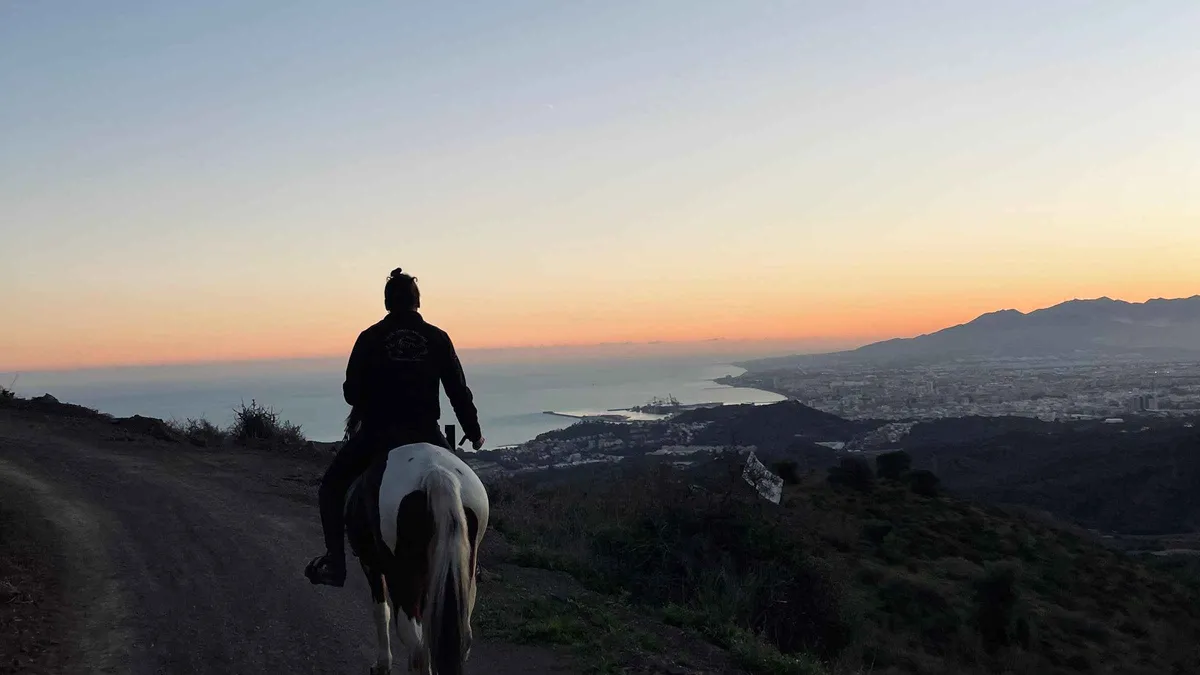
Cheapest entry 1-Hour Horseback Ride through the Montes Málaga Nature Area
An hour on horseback on forest trails in the Montes de Málaga with lookouts over the old town and the bay, matched to your level and open to beginners. You get to the stables in Málaga-Este yourself. The rider limit is 100 kg and the health exclusions are long; read them before booking.
Check Availability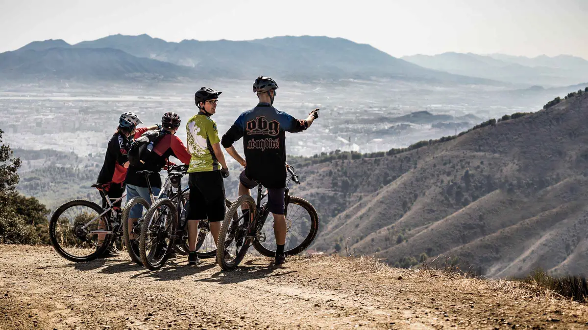 from $76.78
Málaga: Scenic Easy 3-Hour E-Bike Tour in Montes de Málaga
Three hours on a Bosch e-mountain bike from a city-centre shop into the Montes de Málaga: canal path, past La Concepción, then forest tracks to a viewpoint and a mountain restaurant stop before a downhill return through Olletas. Under-12s and non-riders are excluded; a credit card is needed as deposit. Food is not included.
Check AvailabilityPrices, ratings and details are the platform's own; dollar figures are the listed prices — the platform bills in your account's currency.
Málaga Hiking Map: Trailheads, the Ecomuseum and the City Hills
The park's ecomuseum and trailhead cluster to the north, the San Telmo start of the walkable route on the city edge, Monte San Antón above El Palo, the Gibralfaro path and the start of the coast stage.
The Torrijos and San Antón pins are OpenStreetMap positions for the named places. The San Telmo pin is the coordinate printed on the Junta's Picapedreros sheet. The Fuente de la Reina and El Cerrado trailheads are not pinned because no official source gives a coordinate.
The Walks With Their Own Pages
The four pages this one hands over to.
Caminito del Rey
Timed named tickets, the one-way route, the shuttle and the train from María Zambrano.
The gorge walkway, about an hour by roadEl Torcal
The marked circuits and the guided hikes from the city from $48.86.
The karst plateau above AntequeraGibralfaro Castle
The castle, the Coracha and bus 35 for the way down.
132 m, 20 minutes up from the AlcazabaLa Concepción botanical garden
$6.06 (€5.20), free Sunday afternoons, EMT 20 and a 15-minute walk.
6 km north, at the foot of the MontesMálaga Hiking Questions
Is Málaga good for hiking?
For short forest walks, yes: the Montes de Málaga park behind the city signposts four free senderos of 842 m to 2,942 m and the Ayuntamiento publishes three routes up Monte de San Antón. For long or dramatic hikes the answer is a day trip to the Caminito del Rey or El Torcal. The trail table has the park's official lengths and times.
What are the best hiking trails in the Montes de Málaga?
El Cerrado first, the only circuit, 2,942 m in 1 h 20 to the Mirador del Cochino with the bay view. Then Pocopán, 2,889 m one way to its own viewpoint. Torrijos and Umbría de Contadoras are the two short ones. All four are the Junta's, graded Baja or Media, in the trail table. The e-bike tour rides the same forest tracks.
How do I get to the Montes de Málaga without a car?
No Junta sheet names a bus. The options are the walkable Picapedreros to Boticario track from San Telmo on the city edge, a taxi at $5.37 (€4.61) minimum plus $1.22 (€1.05) a kilometre, the horseback hour at $58.17 or the e-bike tour at $76.78. The access table compares them.
How long is the Monte San Antón hike?
The Ayuntamiento gives 2.5 hours with stops for the Ruta de la Cruz to the 491 m summit with 200 m of ascent, about 3.5 hours for the Ruta Circular over the 507 m top, and 3.5 hours over 4 km for the Lagarillo Blanco route with 300 m of ascent. The San Antón table has the grades, and the Pedregalejo page the buses to El Palo below it.
Is there a flat coastal walk from Málaga?
Stage 1 of the GR-249 Gran Senda de Málaga: 15.6 km from the city to Rincón de la Victoria in 3 h 20 with 40 m of ascent in total, along the seafront promenade through La Malagueta, Pedregalejo and El Palo. The coast section has the source, and the beaches hub the sand beside it.
When is the best time of year for hiking near Málaga?
October to May, when average highs run from 15.4°C in January to 22.7°C in October. July and August average 29.2°C with almost no rain, so summer walks start at dawn. The months table has six months from the ERA5 archive and the weather page all twelve.
The Montes de Málaga on Film
Three walks through the pines that show the tracks, the gradients and the views the trail sheets describe in metres and minutes.
Afternoon Hike & Picnic in Parque Natural Montes de Malaga, Andalucía Spain
An afternoon in the park with a picnic at the recreation areas, which is how the short senderos are best used.
Video: Kettle CampingMontes de Málaga, around the Arroyo Don Ventura
The forest tracks and stream beds of the park interior, the terrain the Torrijos and Umbría walks follow.
Video: Bart Van ThienenStella Polaris Senderos . Picapedreros - Boticario.Montes de Málaga
The Picapedreros to Boticario route from San Telmo, the one way into the park that starts at the city's edge.
Video: Stellaleonis MálagaVideos load from YouTube only when you press play.
Prices, hours and terms are set by the venue or operator and confirmed at checkout.
We may earn a commission if you book through one of our links, at no extra cost to you. Full affiliate disclosure